As a warning, if I haven't mentioned it before now, I LOVE the mountains! I have trouble understanding my husband's aunt's comment once (after she took a second or third trip out West and I was commenting on how fantastically interesting I found the Rockies to be) . . . she said something like, "I don't see how anyone gets excited about mountains. Once you've seen them, one rock looks like any other one." I like this lady even though she does freely share her opinion about lots of things. Sometimes she can be far more caustic than others, but that's not the focus of my post today.
Everyone has their lists of likes and dislikes, and if I don't push you into the "I hate mountains and rocks" list, I'll be happy. The more I visit the mountains, the more I wish I'd seriously studied geology. I find all the variety of colors, types of rocks, strata variations, hugeness of it all, how the earth has pushed up layers at odd and dangerous looking angles, etc., etc. quite simply fascinating.
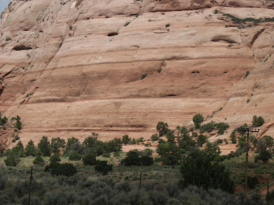
Now, just as a disclaimer, all these photos were shot while moving rapidly down the highway. We had like 12 to 13 hours of driving per day to get to our destination (up or back, depending) so we weren't stopping to picture take. That said, you can judge for yourself if you think they're as cool and I do! Even though you can't get the immensity perspective like being there gives you!
All included pictures in today's photo catalog were shot somewhere between Monticello, Utah and Price, Utah--if I remember correctly.

 This photo shows the obvious layers of copper--hence the bluish/green color strata.
 Talk about HUGE boulders! I wonder sometimes what keeps them from tumbling down on us unsuspecting motorists!
 This monstrous sandstone cliff is only one of many. Arches National Monument is somewhere in the vicinity. I have a shot of one of the arches, Wilson's Arch I was planning to share. (Maybe I can find it and include it still . . . Let's see . . .)
  Ah! Yes. There it is. You may have to click on it to get a better understanding of how large it truly is. Once upon a time, my husband and kiddos (much younger at that time, you understand) and I hiked up that rock to the middle of the arch. Well, I think I didn't quite make it ALL the way up, but it's lots bigger/farther than you might think. IF you do click on this image, you can see a couple of folks who did make the hike--successfully.
 This rock fascinates me. It's so out there and all alone. AND it looks like a funny clay pot! You have to wonder (or at least I do) how it managed to stand there all these centuries while the rest of the rock that used to be part of it blew or washed away. The various color strata also intrigue me. And see the cave at the bottom?
 There're a few more humongous boulders for you to appreciate!
Oh, I should probably also mention that all this area was once under water. Don't exactly know all the data--like I thought I did. Lake Bonneville was part of an ancient "sea" the covered a lot of western Utah, some of southern Idaho and eastern Nevada. The Great Salt Lake is the lowest point of what's left of that ancient "lake" and the famous Bonneville Salt Flats are a remnant of it as well. I was thinking this more eastern part of Utah had also been under that huge "lake" but, when I looked it up (on Google) I didn't find confirmation for that, so I don't know what I'm talking about. Thought I remembered learning that all of Utah, and much of the west/southwest was under that BIG lake--you know, back a millennia or so ago when I was in high school. Guess I DO indeed need to take some geology classes! Get the facts straight! Right?
No comments:
Post a Comment